—
Perth’s Most Scenic 10K Road Route
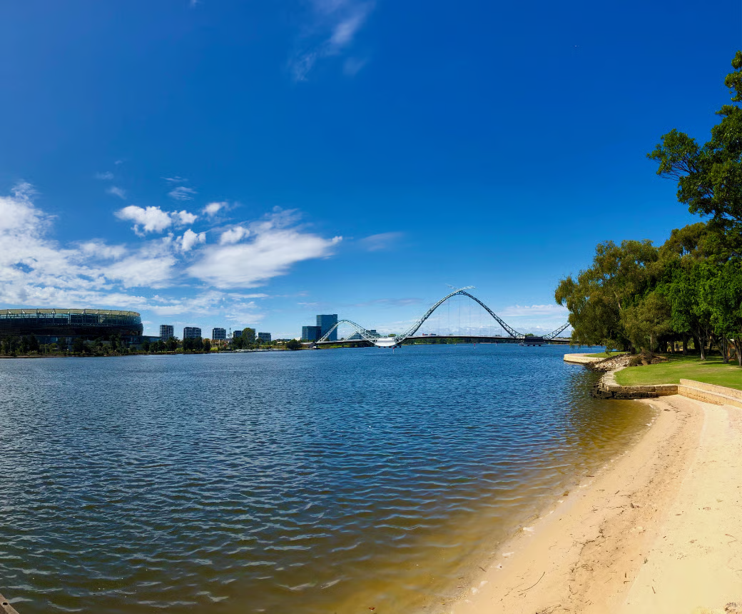
If you’re hunting for the best Swan River running route Perth has to offer, you’ve already found it. The classic Swan River loop between the CBD foreshore and Mounts Bay Road is Perth’s go-to flat 10K — and once you’ve run it at sunrise with the city skyline reflecting off the water, you’ll understand why locals keep coming back.
This route is accessible, well-lit, mostly paved, and almost entirely flat. Whether you’re building your base fitness or just want a reliable road route that doesn’t involve dodging traffic on Hay Street, this one delivers.
—
The Route at a Glance
Distance: ~10 kilometres (full loop)
Elevation gain: Minimal—under 30 metres total
Surface: Paved path and footpath throughout
Difficulty: Easy to moderate
Best for: Beginners, recreational runners, anyone chasing a flat 10K run in Perth
The loop runs along both the north and south banks of the Swan River, connecting via the Narrows Bridge and the Causeway (or Windan Bridge). Most runners start near Elizabeth Quay or the WACA end and go in either direction—clockwise or anticlockwise; it’s equally good.
—
The Full Route Breakdown
Starting Point: Elizabeth Quay / Barrack Street Jetty
This is the most popular entry point. You’ve got free parking nearby on weekends along Riverside Drive, and public transport drops you practically at the waterfront. Start your GPS watch, face the river, and head east along the foreshore path.
The first 2–3 kilometres heading east toward the Causeway are genuinely lovely — you’re running with the Swan on your left, the city behind you, and the WACA precinct coming up on your right. The path is wide, well-maintained, and shared with cyclists, so stay left.
Crossing the Causeway: The Halfway Mark
Around the 4–5K mark, you’ll cross the Causeway into South Perth. This is the turnaround point for many out-and-back runners, but if you’re doing the full loop, you’ll swing right and head west along the south bank.
The South Perth foreshore stretch is quieter than the north bank — fewer cyclists, better views back across to the city, and some decent shade from the trees lining the path. On a clear day, the Perth skyline from this angle is genuinely hard to beat.
The Narrows Bridge Return
Follow the path west past the South Perth foreshore, under the freeway, and up toward the Narrows Bridge. This is the only real “climb” on the route—a short ramp up and over the bridge. It’s maybe 15 metres of elevation. If that breaks you, we need to talk about your preparation.
Cross back to the north bank, drop down to Mounts Bay Road, and run east back toward Elizabeth Quay to complete your loop. Job done.
—
Practical Details
Parking
- Riverside Drive — free on weekends, limited on weekdays
- Elizabeth Quay car park — paid, but cheap on weekends
- South Perth foreshore — free parking off Melville Parade if you want to start on the south bank
Water and Toilets
Water fountains and public toilets are available at:
- Elizabeth Quay
- Langley Park (north bank, around 2K in)
- South Perth foreshore (multiple points)
- Narrows Bridge approach (south side)
You shouldn’t need to carry water for a 10K on this route, but if it’s summer and you’re heading out past 8am — bring a bottle. Perth heat is not to be underestimated.
Best Time to Run
- Sunrise (5:30–7 am) — Cooler, stunning light on the water, far fewer cyclists
- Early evening (6–8 pm) — Popular, social, great city lights on the return leg
- Midday in summer — Possible but not advised. The north bank path has limited shade and Perth summer afternoons are brutal.
—
What Makes This Perth’s Best Riverside Running Path
A lot of cities claim a great riverside running path. Perth’s Swan River loop genuinely earns the title for a few reasons:
- Almost zero road crossings. You can zone out to your playlist without constantly stopping at lights.
- Consistent surface. No trail tech required — road shoes or even a decent pair of trainers will handle this comfortably.
- Landmarks to break it up. You’ve got Elizabeth Quay, the WACA, the Causeway, the South Perth foreshore, and the Narrows — enough variation to stop it feeling like endless repetition.
- It connects to everything. Kings Park trails are minutes away if you want to bolt on extra distance. The Perth CBD and Northbridge are walkable if you want post-run food.
For those exploring other flat 10K runs in Perth, Bibra Lake and the Joondalup foreshore paths are worth knowing about — but the Swan River loop is the benchmark.
—
Running Clubs That Use This Route
You don’t have to run this one solo. Several Perth running clubs use the Swan River foreshore as a regular training ground. Group runs along this route are common on Tuesday and Thursday evenings and weekend mornings.
Check our Perth run clubs directory to find a group near you — there’s a solid mix of beginner-friendly social runs and more structured training groups that operate in and around the CBD foreshore.
Running with a group on this route is particularly good for beginners. It’s easy to navigate, there’s no technical terrain to worry about, and you can focus on keeping up (or keeping pace) without getting lost.
—
Gear for This Route
This is a road route, so you don’t need anything fancy. That said, a few things make a difference:
- Road running shoes — cushioned, lightweight. Check what’s available in our running shop if you’re due for a new pair.
- Sunglasses and a cap — mandatory for morning runs when you’re running east into the sunrise, or afternoon runs heading west
- GPS watch or running app — useful for tracking the full 10K, especially if you’re adjusting the loop length
- Hydration vest or handheld bottle — only if you’re extending beyond 10K or running in summer heat
Recommended Road Running Shoes — Quick Comparison
| Shoe | Best For | Weight | Buy |
|---|---|---|---|
| ASICS Gel-Nimbus 26 | High-mileage comfort | 290g | View in Shop |
| Nike Pegasus 41 | Everyday training | 280g | View in Shop |
| Brooks Ghost 16 | Neutral, plush feel | 298g | View in Shop |
| New Balance Fresh Foam X 1080v14 | Long run cushioning | 285g | View in Shop |
—
Extending the Route
If 10K isn’t enough, there are easy ways to add distance:
- Kings Park add-on: At the Narrows Bridge end, cut up into Kings Park for an extra 3–5K of trails and elevation. The Fraser Avenue entry is right there.
- Cottesloe extension: Head west along the foreshore past Crawley and Point Resolution Reserve toward Pelican Point for a longer riverside stretch.
- South Perth loop extension: Stay on the south bank longer and loop through Como before crossing back.
For more route ideas across Perth, browse our runners’ guides and blog.
—
The Bottom Line
The Swan River running route in Perth is the city’s most reliable, scenic, and accessible flat 10K. It’s easy to navigate, consistently maintained, and beautiful enough that you won’t mind the out-and-back stretch on the return leg.
Run it once and you’ll have it on permanent rotation. That’s not a guarantee — but it might as well be.
For more Perth running routes, club listings, and gear, head back to perthrunningclubs.com.
External resource: For trail conditions and path maintenance updates around the Swan River, check Burswood Park and the Department of Biodiversity, Conservation and Attractions — they manage several sections of the foreshore paths.